Chetro Ketl Trail,
Chaco Culture National Historical Park
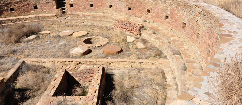
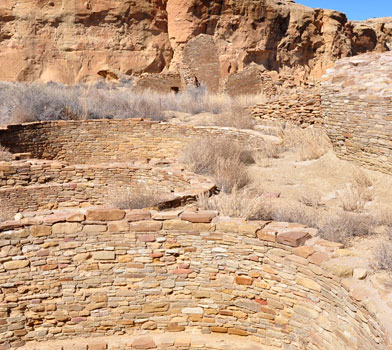
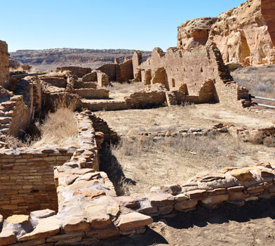
This short, graveled trail rises steeply in several locations and loops around the remains of what is referred to by archeologists as the Great House.


The buildings are believed to have been used by traveling ancient Puebloans. Many of the multi-storied rooms were also used by the ancient Puebloan families who lived here. The site of Chetro Ketl is spread across three acres and contains over 400 rooms, many of the rooms were designated as storage for squash, corn and beans. There's also several small kiva's here, including a Great Kiva which measures over 61 feet in diameter. The Chacoans would use these Kivas as a place to perform rituals and ceremonies. The ancient Puebloan people began construction of the Great House during 990 AD, the majority of the buildings were completed by the year 1075.
Many of the Chacoan people who inhabited this area left during the year 1140 due to a severe draught. According to archeological evidence, it is believed that the structure was completely abandoned by 1250.
Elevation
The Chetro Ketl Trail has a maximum elevation of 6,187 ft., a minimum elevation of 6,137 ft. and an elevation range of 50 ft.
Metrics
| [ A to B ] or [ B to A ] | |||
|---|---|---|---|
| Length 2 | Min Ele 3 | Max Ele 4 | Range 5 |
| 0.5 mi | 6,137 ft | 6,187 ft | 50 ft |
| [ A to B ] | |||
|---|---|---|---|
| Time 6 | Floors 7 | Gain 8 | Loss 9 |
| 15 min | 3.9 | 47 ft | 24 ft |
| [ B to A ] | |||
|---|---|---|---|
| Time | Floors | Gain | Loss |
| 15 min | 2.0 | 24 ft | 47 ft |
Calories
The following chart shows the total calories that you may expend on the trail while hiking in both directions. The chart is based on data derived from a statistical model of energy expenditure that relates gross weight, typical speed and trail topography.
Topo Maps
Download the PDF Chetro Ketl Trail topo map and the adjoining quads to plan your hike. These are full-sheet, 7.5 Minute (1:24,000 scale) topographic maps.
Adjoining 7.5' Quadrangle Legend
- Northwest Topo Map: Pretty Rock, NM
- North Topo Map: Pueblo Bonito NW, NM
- Northeast Topo Map: Kimbeto, NM
- West Topo Map: Kin Klizhin Ruins, NM
- Topo Map: Pueblo Bonito, NM
- East Topo Map: Sargent Ranch, NM
- Southwest Topo Map: Nose Rock, NM
- South Topo Map: Seven Lakes NW, NM
- Southeast Topo Map: Seven Lakes NE, NM
FAQ
What is the length of the Chetro Ketl Trail?
The length of the trail is 0.5 miles (0.9 km) or 1,190 steps.
How long does it take to hike the Chetro Ketl Trail?
A person in good physical health can hike the trail in 15 minutes in one direction and in 15 minutes in the opposite direction.
Warnings
Prevent tick bites: Treat clothing and gear, such as boots, pants, socks and tents with products containing 0.5% permethrin.
(cdc.gov)
- The Brown dog tick (Rhipicephalus sanguineus) may be present in this area. The Brown dog tick transmits Rocky Mountain Spotted Fever.
Footnotes
- Steps is a unit of distance equal to the sum of stride lengths that vary with the terrain.
- Length is the distance of the trail between the two trailheads, measured on the trail.
- Min Ele is the minimum elevation on the trail.
- Max Ele is the maximum elevation on the trail.
- Range is the difference between maximum and minimum elevation.
- Time is the typical total time required to hike the trail.
- Floors is the gain divided by twelve feet, the height of one floor.
- Gain (cumulative elevation gain) is the sum of every gain in elevation.
- Loss (cumulative elevation loss) is the sum of every loss in elevation.
