
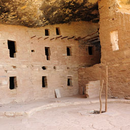
Knife Edge Trail,
Mesa Verde National Park

The Knife Edge Trail is an interpretive trail located within Morefield Campground. Leaflets are available at the trailhead. The trail was once known as Knife Edge Road which was the original entrance into the park, it's difficult to imagine this when you're on the trail itself.


The trail has little elevation change and will come to an abrupt stop with a warning sign from the National Park Service. At the end of the trail you will see amazing views of the Montezuma Valley.
Elevation
The Knife Edge Trail has a maximum elevation of 7,871 ft., a minimum elevation of 7,797 ft. and an elevation range of 74 ft.
Metrics
| [ A to B ] or [ B to A ] | |||
|---|---|---|---|
| Length 2 | Min Ele 3 | Max Ele 4 | Range 5 |
| 1.0 mi | 7,797 ft | 7,871 ft | 74 ft |
| [ A to B ] | |||
|---|---|---|---|
| Time 6 | Floors 7 | Gain 8 | Loss 9 |
| 20 min | 4.1 | 49 ft | 62 ft |
| [ B to A ] | |||
|---|---|---|---|
| Time | Floors | Gain | Loss |
| 21 min | 5.2 | 62 ft | 49 ft |

Calories
The following chart shows the total calories that you may expend on the trail while hiking in both directions. The chart is based on data derived from a statistical model of energy expenditure that relates gross weight, typical speed and trail topography.
Topo Maps
Download the PDF Knife Edge Trail topo map and the adjoining quads to plan your hike. These are full-sheet, 7.5 Minute (1:24,000 scale) topographic maps.
Adjoining 7.5' Quadrangle Legend
- Northwest Topo Map: Dolores West, CO
- North Topo Map: Dolores East, CO
- Northeast Topo Map: Millwood, CO
- West Topo Map: Cortez, CO
- Topo Map: Point Lookout, CO
- East Topo Map: Mancos, CO
- Southwest Topo Map: Wetherill Mesa, CO
- South Topo Map: Moccasin Mesa, CO
- Southeast Topo Map: Trail Canyon, CO
FAQ
What is the length of the Knife Edge Trail?
The length of the trail is 1.0 miles (1.6 km) or 2,111 steps.
How long does it take to hike the Knife Edge Trail?
A person in good physical health can hike the trail in 20 minutes in one direction and in 21 minutes in the opposite direction.
Warnings
Prevent tick bites: Treat clothing and gear, such as boots, pants, socks and tents with products containing 0.5% permethrin.
(cdc.gov)
- The American dog tick (Dermacentor variabilis) may be present in this area. The American dog tick transmits Tularemia and Rocky Mountain Spotted Fever.
- The Brown dog tick (Rhipicephalus sanguineus) may be present in this area. The Brown dog tick transmits Rocky Mountain Spotted Fever.
- The Rocky Mountain wood tick (Dermacentor andersoni) may be present in this area. The Rocky Mountain wood tick transmits Rocky Mountain Spotted Fever, Colorado Tick Fever, and Tularemia.


Footnotes
- Steps is a unit of distance equal to the sum of stride lengths that vary with the terrain.
- Length is the distance of the trail between the two trailheads, measured on the trail.
- Min Ele is the minimum elevation on the trail.
- Max Ele is the maximum elevation on the trail.
- Range is the difference between maximum and minimum elevation.
- Time is the typical total time required to hike the trail.
- Floors is the gain divided by twelve feet, the height of one floor.
- Gain (cumulative elevation gain) is the sum of every gain in elevation.
- Loss (cumulative elevation loss) is the sum of every loss in elevation.